Conservation Halton Virtual Meeting!


Conservation Halton has retained consulting and engineering company, Wood, to update the floodplain mapping and modelling. Advances in technology allows us to better understand flood hazards and to develop more accurate floodplain mapping. One of Conservation Halton’s top priorities is to protect life and property from natural hazards and updating floodplain mapping is one of the ways they do that.
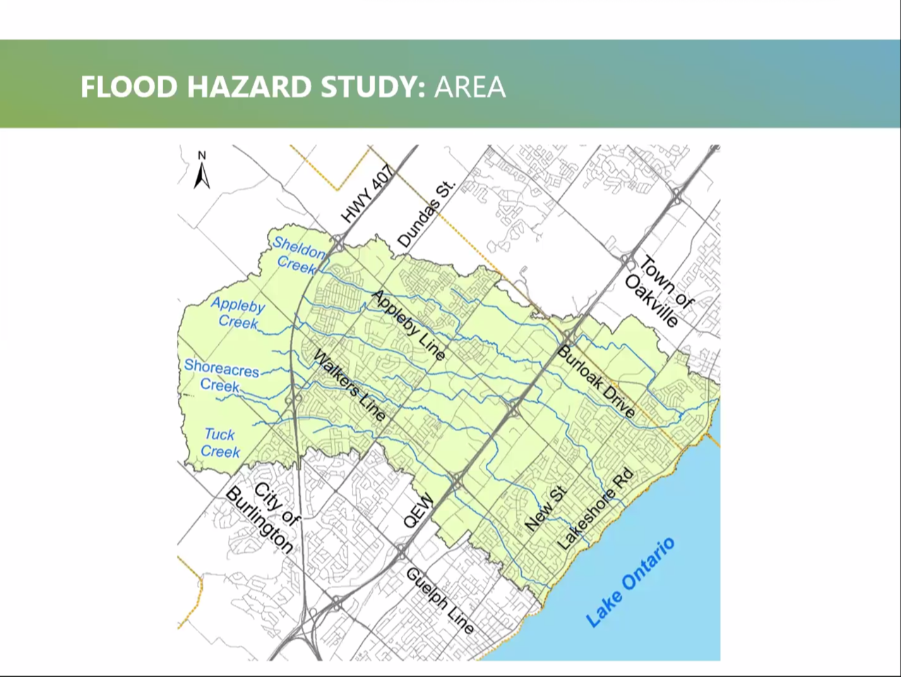
Floodplain mapping is used by Conservation Halton and municipal partners to identify areas that may be susceptible to riverine or shoreline flooding, and to inform flood forecasting, emergency response, community planning, infrastructure upgrades and other flood prevention efforts. A floodplain is an area of land that is flooded by a nearby creek or lake during large storms.
Public Engagement
An important part of the process of updating floodplain mapping is to inform and engage with residents and other stakeholders in the study area.
Please send in your flood stories and photos to the admin team at admin@millcroftagainstdevelopment.ca and to Matt at Conservation Halton (mhowatt@hrca.on.ca)
and Matt at Wood Enviromental.(matt.senior@plc.com)